Hunterizer vs. OnX: Hunting Information for Beale Air Force Base
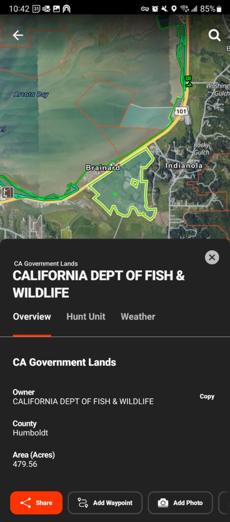
In the following example of Beale Air Force Base, both Hunterizer and OnX display the area as public land. However, when it comes to determining whether hunting is allowed and what specific regulations apply, the differences between the two platforms become clear.
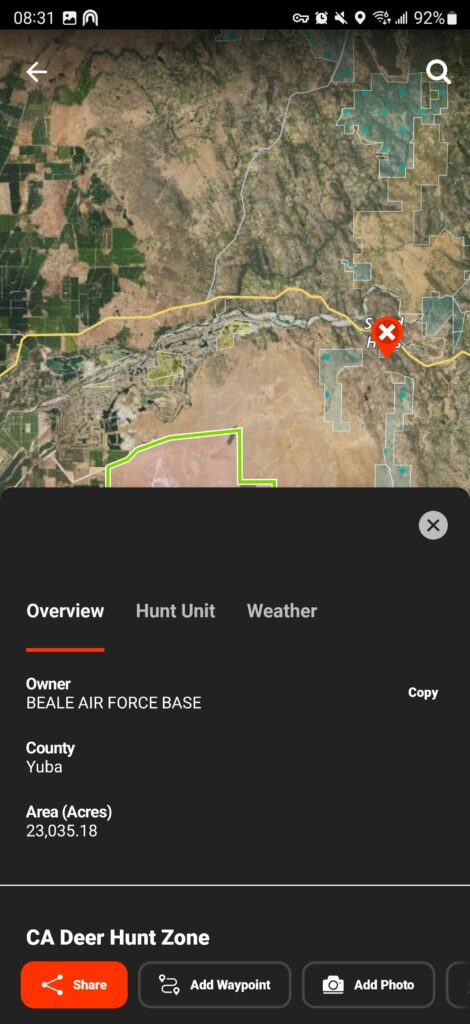
OnX Example
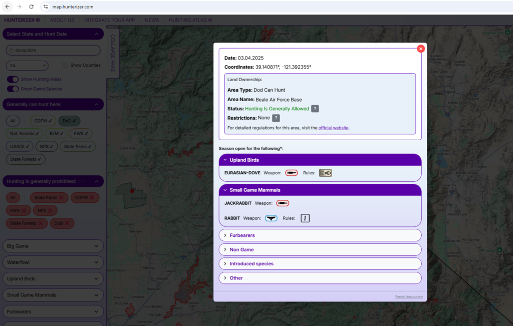
Hunterizer Example
OnX – Limited Hunting Data
OnX provides a basic map layer showing Beale Air Force Base as a public land parcel, but it does not offer any information on hunting accessibility. The map does not indicate whether hunting is permitted, which species can be legally harvested, what weapon restrictions exist, or what licensing requirements apply. This leaves hunters with unanswered questions and forces them to search elsewhere for regulations.
Hunterizer – Detailed Hunting Information at a Glance
Hunterizer takes hunting accessibility a step further by integrating detailed, area-specific regulations directly into the map. Instead of just showing the land boundary, Hunterizer provides:
- A clear indication that hunting is allowed on Beale Air Force Base.
- A direct link to official government regulations, so users can verify details from the authoritative source.
- Specific restrictions (if any)—in this case, none exist.
- A breakdown of huntable species—for example, jackrabbits can be hunted with any approved weapon, while rabbits can only be taken using falconry.
- Weapon-specific regulations to clarify which hunting methods are legal.
- License and tag information, ensuring hunters know what permits they need before heading out.
With Hunterizer, you don’t just see the land—you get the complete picture. By putting all the essential hunting details right on the map, Hunterizer eliminates the need for additional research, making it easier to find and plan your next hunt with confidence.
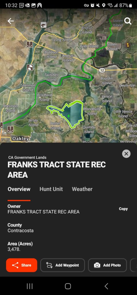
Hunterizer vs. OnX: Hunting Information for Franks Tract State Recreation Area
Just like Beale Air Force Base, OnX displays Franks Tract State Recreation Area as public land but provides no hunting-specific details. Hunters are left uncertain about whether hunting is allowed, which species can be taken, or what restrictions apply.
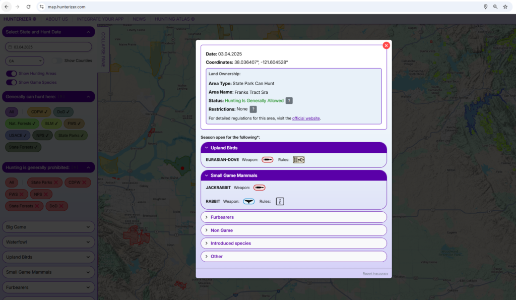
Hunterizer, on the other hand, clearly indicates that waterfowl hunting is permitted in designated areas. It also provides a direct link to official regulations, highlights zone-specific restrictions, and outlines species, weapon allowances, and license requirements.
This is yet another example of how Hunterizer goes beyond just mapping public land—it delivers the complete hunting picture so users can confidently plan their hunt without searching for scattered information.
OnX Example
Hunterizer Example
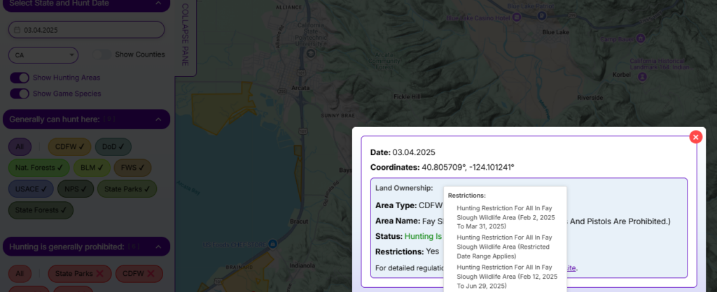
Hunterizer vs. OnX: Hunting Information for Fay Slough Wildlife Area
Similar to previous examples, OnX shows Fay Slough Wildlife Area as public land but lacks key hunting details. It doesn’t indicate whether hunting is allowed, what restrictions apply, or which species can be legally hunted beyond basic deer zone data.
Hunterizer, however, provides a complete hunting breakdown for the area:
- Clearly states that hunting is allowed.
- Displays area-specific restrictions to keep hunters informed.
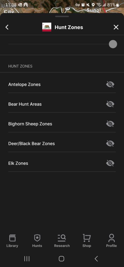
- Covers all 50+ species zones, rather than limiting information to deer.
- Lists huntable species for today, factoring in all relevant restrictions.
Once again, Hunterizer eliminates the guesswork, making it easy for hunters to see exactly where, when, and what they can legally hunt—all in one place.
OnX Example
Hunterizer Example
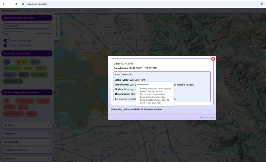
Hunterizer vs. GoHunt: Don Edwards National Wildlife Refuge
While GoHunt provides information on big game hunting zones, this data is irrelevant for Don Edwards National Wildlife Refuge, where only waterfowl hunting is permitted. Hunters relying on GoHunt may be misled into thinking big game hunting applies here when it does not.
Hunterizer, on the other hand, delivers accurate, area-specific hunting information:
- Clearly indicates that hunting is allowed in this refuge.
- Provides a direct URL to official regulations for verification.
- Lists restrictions, noting that only waterfowl hunting is permitted.
- Shows hunting availability for today—in this case, indicating that waterfowl season is over and no active hunting is allowed.
This comparison highlights how Hunterizer prioritizes relevant, up-to-date hunting details, ensuring hunters have the right information for the right location at the right time.
GoHunt Example

GoHunt Example
Hunterizer Example
Related Guides
- onX vs Hunterizer: Full Comparison — Land ownership maps vs location-based regulation lookup — two different questions.
- Best Hunting Apps for Season Dates & Regulations — Full 2026 comparison of Hunterizer, onX, HuntStand, HuntWise, and GoHunt.
- What Can I Hunt Today? — The core use case — open seasons by GPS coordinate, right now.